Episode 27, 22 November 2022
Analysis
Description
Meteorological background
In the weeks leading up to the flood, two significant low-pressure systems crossed the Adriatic: the first on 4 November and the second on 16–17 November. On the night of 21–22 November, rapid cyclogenesis occurred in the Ligurian Sea, with the cyclone moving across the Apennine Peninsula toward the Adriatic on 22 November, reaching 990 hPa in the centre. This system brought strong to gale-force southeast and south winds over the Adriatic prior to the sea-level peak in Bakar. As the cyclone moved over the Adriatic, a variable wind field developed: the Sirocco wind affected the southern and middle Adriatic, while the Bora wind, at strong to gale force, prevailed over the northern Adriatic. These atmospheric conditions resulted in substantial rainfall along the Croatian coast, particularly in the northern Adriatic. For instance, the Cres station recorded 132.5 mm of rain in 24 hours from 22 to 23 November (source: DHMZ).
Sea-level evolution
On the morning of 22 November 2022, the sea level in Bakar rose to 101 cm above the long-term average. This peak coincided with a semidiurnal spring tide, which contributed 30 cm to the flood. An atmospheric disturbance on 18 November did not induce significant basin-wide oscillations, resulting in the absence of pre-existing seiches (T~21.2 h). Therefore, synoptic component was primarily a storm surge, peaking at 56 cm. However, the total sea-level maximum occurred before this peak, when synoptic component was at 20 cm.
The remaining sea-level rise resulted from processes acting on other time scales (refer to Figure 1 in the Introduction for detailed explanations). High-frequency oscillations contributed 12 cm, planetary-scale variability added 20 cm, and long-term sea-level change added 19 cm.
In this episode, all processes had positive contributions, with tide having the greatest impact. The synoptic, planetary-scale, and long-term sea-level change had similar effects, while high-frequency oscillations had the smallest impact.
Newspaper reports
Here are excerpts from reports about the flood from various online sources.
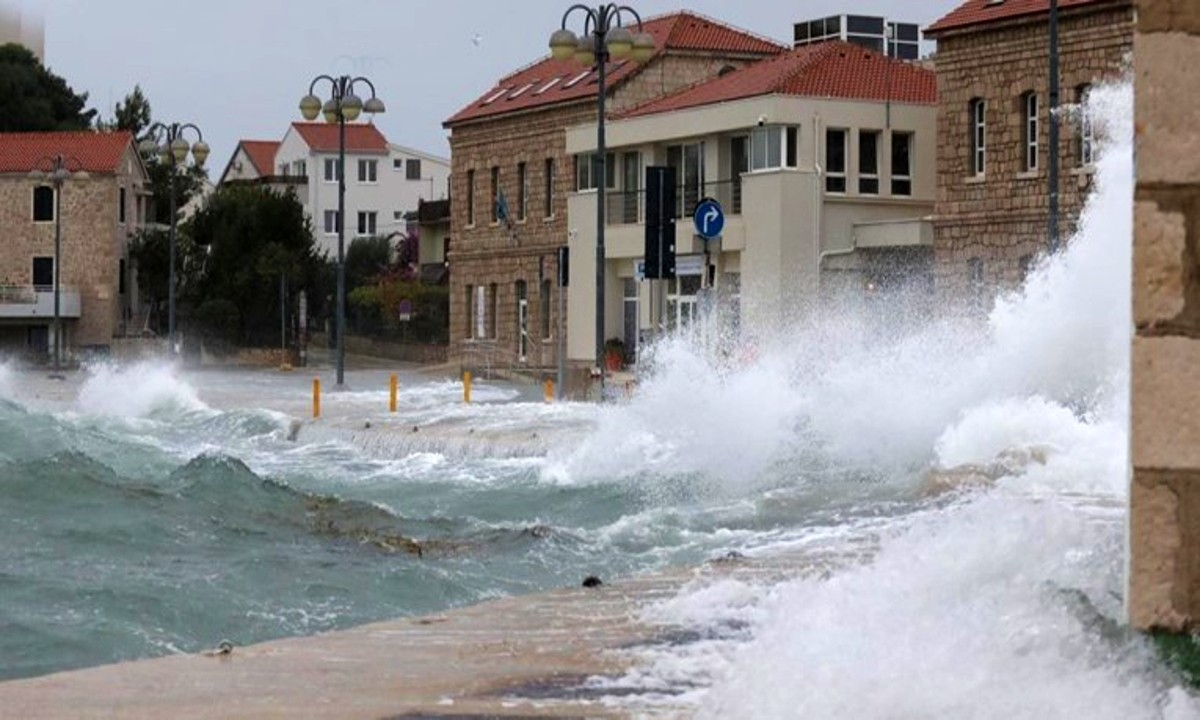
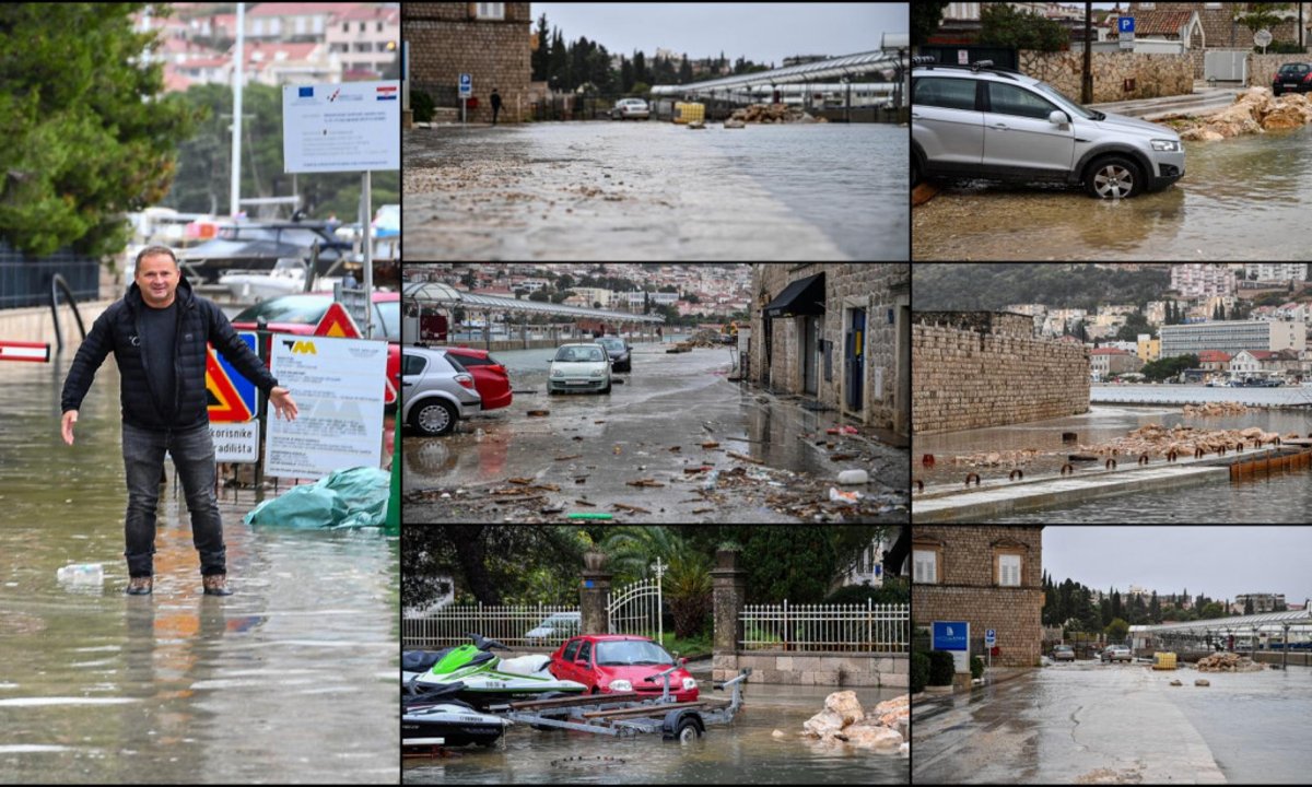
From Pula to Dubrovnik, the Adriatic coast experienced widespread flooding of cellars, residential and commercial buildings, including restaurants, cafés, stores and farmers’ markets. Due to the considerable amount of water, numerous sections of state, county and municipal roads had to be closed, causing significant traffic disruptions and delays. In addition, ferry and catamaran services between the mainland and most of the Kvarner and Dalmatian islands were suspended. There were reports of fallen trees and rockslides blocking the roads. In the municipality of Gračišće, which is located in the interior of Istria, there was a power cut throughout the day. The strong Sirocco also led to the collapse of dry stone walls in Split – Dalmatia County. In addition, the river Cetina burst its banks in Omiš and caused flooding in the old part of the town, forcing the fire department to intervene to pump out the water.


