Episode 17, 23 December 2009
Analysis
Description
Meteorological background
In the days leading up to the sea-level peak in Bakar, several intense cyclones crossed the Adriatic, causing variable winds and multiple episodes of strong, prolonged southeasterly and southerly winds. This cyclonic activity was driven by a vast upper-level trough spanning from Greenland to North Africa and extending to Russia, with southwesterly flow on its leading edge bringing warm air from northern Africa to the Adriatic. Two cyclones formed in the Mediterranean on 19 and 22 December, bringing heavy precipitation and southerly and southeasterly winds as they moved eastward. On 23 December at 00:00 UTC, a decisive cyclone developed over the Gulf of Genoa. The increasing air-pressure gradient along the Adriatic’s east coast caused a strong Sirocco wind, peaking just before the occlusion front passed.
Sea-level evolution
On 23 December 2009 at 02:00 UTC, the sea level in Bakar reached 98 cm above the long-term average. The overall sea-level maximum occurred one hour after the daily high tide, with tide contributing 14 cm to the flood. This episode was influenced by natural basin oscillations (~21.2 hours), initially triggered on 19 December when a cyclone crossed the Adriatic (causing a sudden shift in wind speed and direction). As a result, synoptic component included both storm surges and free basin-wide oscillations. The pre-existing seiches were in phase with the newly induced storm surge, amplifying its impact. The overall sea-level maximum coincided with the peak of synoptic component, which contributed 41 cm.
The remaining sea-level rise resulted from processes acting on other time scales (refer to Figure 1 in the Introduction for detailed explanations): high-frequency oscillations did not make a contribution (0 cm), planetary-scale variability added 18 cm, and long-term sea-level change added 25 cm.
The flood can be attributed to a positive superposition of all processes, aside from those at high frequencies, but above all to synoptic component, which was dominated by free basin oscillations.
Newspaper reports
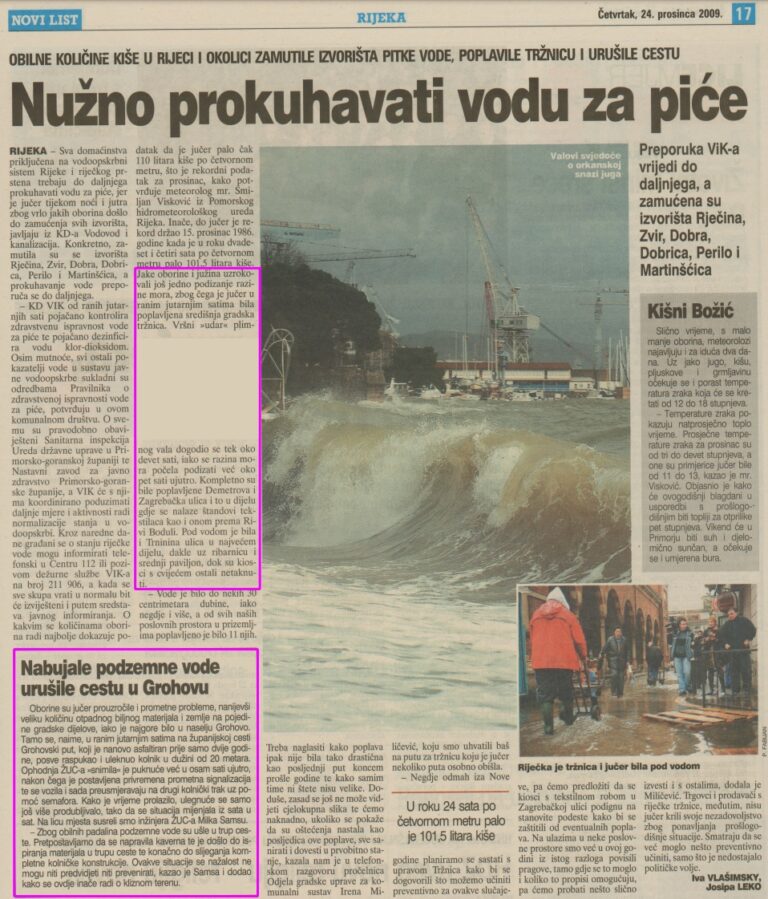
Here are excerpts from a report about the flood from Novi list.
Heavy rains and sirocco winds have caused another rise in sea levels, flooding the city’s central market early yesterday morning. The peak of the tidal wave reached around nine o’clock, although the sea level began to rise at five o’clock in the morning. Demetrova and Zagrebačka streets were completely flooded, especially the area where the textile stalls are located, as well as towards Riva Boduli. Most of Trnina Street was also under water, especially around the fish market and the central pavilion, while the flower kiosks were not affected.
Rising groundwater has eroded the road in Grohovo
Yesterday’s rains also caused traffic problems and deposited a large amount of plant debris and soil in some parts of the city, but the worst was in the settlement of Grohovo. In the early hours of the morning, 20 meters of the Grohovski put district road, which had only been resurfaced two years ago, collapsed completely and caved in. The road maintenance team discovered the crack at eight o’clock in the morning. Temporary traffic signals were then set up and vehicles are now diverted to the other lane with the help of traffic lights. Over time, the sinkhole continued to deepen, so that the situation changed from hour to hour…
