Episode 5, 23 January 1966
Analysis
Description
Meteorological background
From 15 to 22 January, the Adriatic was positioned between a cold air mass from the north, associated with a surface anticyclone, and a warm air mass to the south. In this zone, cyclones moved eastward one after another. On 22 January, a cyclone from the Bay of Biscay reached mainland Europe, pushing the anticyclone northward. At the same time, a secondary cyclone developed in the Gulf of Genoa, inducing southeasterly winds over the Adriatic. On 23 January, the Gulf of Genoa cyclone moved southeast across the Adriatic, while an anticyclonic ridge strengthened from the west. This caused strong to gale-force southeasterly winds overnight and into the morning, which gradually shifted to westerly and then northwesterly by the afternoon.
Sea-level evolution
On 23 January 1966, at 05:00 UTC, the sea level in Bakar reached 94 cm above the long-term average. The overall maximum occurred one hour before the daily tidal peak, with tide contributing 16 cm. Synoptic component was influenced by pre-existing natural basin oscillations (~21.2 hours) that were gradually developed and strengthened. The main event occurred when a cyclone approached the Adriatic, generating southeastern winds that drove water into the basin’s closed end. This synoptic component, a combination of pre-existing seiches and a newly generated storm surge, contributed 55 cm to the flood.
The remaining sea-level rise resulted from processes acting on other time scales (refer to Figure 1 in the Introduction for detailed explanations). High-frequency oscillations had minimal impact, adding 4 cm, planetary-scale variability added 12 cm, and long-term sea-level change contributed 7 cm.
The flood was driven by the positive contributions of all involved processes, particularly synoptic component.
Newspaper reports
Here are excerpts from reports about the flood from Novi list and Večernji list.
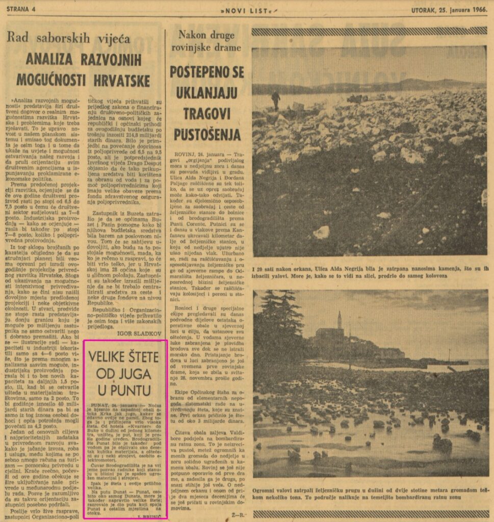
CONSIDERABLE DAMAGE CAUSED BY SIROCCO WIND IN PUNAT
PUNAT, January 24 /– Last night a strong Sirocco wind, the likes of which has not been seen for a long time, raged on the west coast of the island of Krk. As a result, a great deal of damage was caused. On a stretch of one kilometer from the hotel “Kvarner” to Buka, the road that was renovated last year was destroyed. The Punat shipyard was also flooded, so that about ten cubic meters of material was washed away, and some machines, especially electric motors, were damaged.
The shipyard’s security guard immediately called the workers living nearby and rescued the endangered materials and machinery. Nevertheless, the damage remains considerable.
On the Dunat — Punat road, especially in the area around Dunat itself, the sea also caused considerable damage and washed out parts of the road connecting Punat with other places on the island.
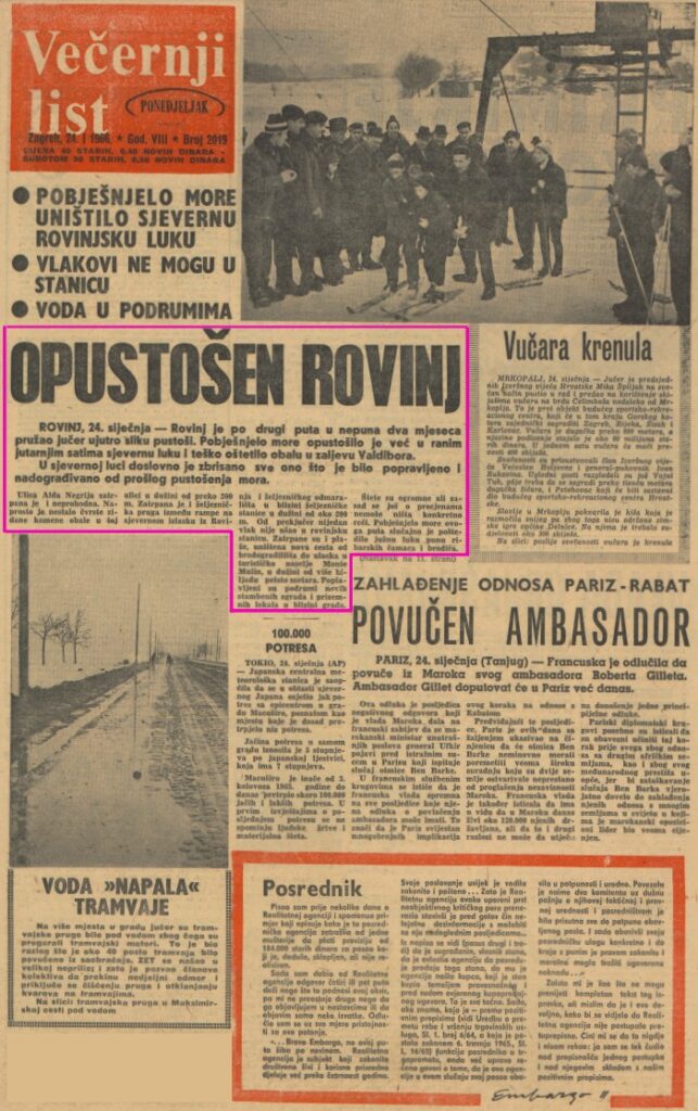
RAVAGED ROVINJ
ROVINJ, January 24 — For the second time in less than two months, Rovinj presented a picture of devastation yesterday morning. The raging sea had already devastated the northern harbor in the early morning hours and severely damaged the coastline in Valdibora Bay.
In the northern port, everything that had been repaired and modernized since the last devastation by the sea was literally wiped out.
Alda Negri Street is buried and impassable. The massive stone wall along this road, which was over 200 meters long, has simply disappeared. The railroad track between the ramp on the northern outskirts of Rovinj and the railroad facility near the train station is buried over a distance of about 200 meters. No trains have arrived at Rovinj station since the day before yesterday. Beaches are buried, the new road from the shipyard to the entrance of the Monte Mulin resort is destroyed over a length of more than one and a half kilometers. Basements of new residential buildings and ground-level stores near the town are flooded. The damage is enormous, but no concrete estimates can yet be made. This time the raging sea has inadvertently spared the southern harbor, which is full of fishing boats and small vessels.

