Episode 16, 1 December 2008
Analysis
Description
Meteorological background
The period before this episode featured intense cyclonic activity. On 27 November, a surface-based cyclone entered the Mediterranean from north Africa, as the Adriatic anticyclone weakened and temperatures gradually dropped with the eastward shift of an upper-level ridge. The cyclone deepened as it moved toward the Gulf of Genoa, northern Italy, and the Adriatic.
On 29 November, an arrival of cold, unstable air from northwest Europe led to the development of a new cyclone in the Bay of Biscay, with pressure in the centre dropping to 985 hPa. Its frontal system moved into Western Europe, forming another cyclone in the Gulf of Lion. This cyclone advanced rapidly eastward, affecting the Adriatic on 30 November. Meanwhile, the original Bay of Biscay cyclone crossed France, and due to the constant inflow of the cold air within the upper-level trough over western Europe and the Mediterranean, another cyclone formed in the western Mediterranean. This cyclone intensified to 995 hPa near the Gulf of Genoa and moved across northern Italy over the Adriatic.
On 1 December, a ~20 hPa pressure gradient over the Adriatic generated strong Sirocco winds, particularly near the eastern coast. Persistent low pressure, multiple cyclones, and their frontal systems brought days of strong southerly winds and locally heavy precipitation.
Sea-level evolution
On 1 December 2008 at 07:00 UTC, the sea level in Bakar rose to 105 cm above the long-term average. This total sea-level maximum occurred during the daily tidal peak, which contributed 23 cm. The maximum was reached just before the peak of synoptic component, which was partially influenced by pre-existing seiches (~21.2 hours). Natural basin-wide oscillations, present in synoptic component since 21 November, were sustained by a series of cyclones crossing the Adriatic. These cyclones caused sudden wind shifts, triggering and amplifying the seiches. The seiche period and the timing of their amplification indicate that they contributed to intensifying the flood. The combination of pre-existing oscillations and a storm surge, driven by strong winds over the middle Adriatic (with maximum speeds near the eastern coast), resulted in a significant synoptic sea-level response of 43 cm.
The remaining sea-level rise resulted from processes acting on other time scales (refer to Figure 1 in the Introduction for detailed explanations): high-frequency oscillations added 9 cm, planetary-scale variability contributed 17 cm, and long-term sea-level change added 13 cm.
In summary, the flood resulted from the combined contributions of all sea-level processes, with synoptic component being the most significant.
Newspaper reports
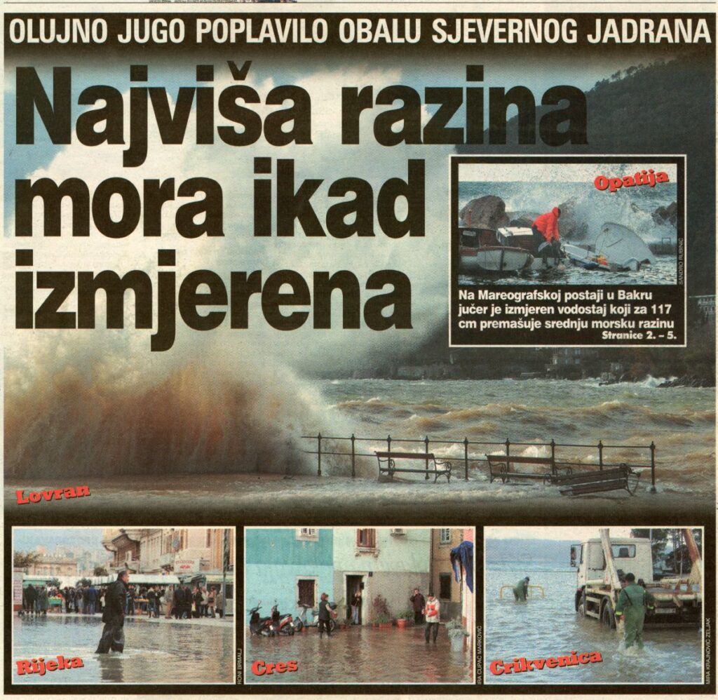
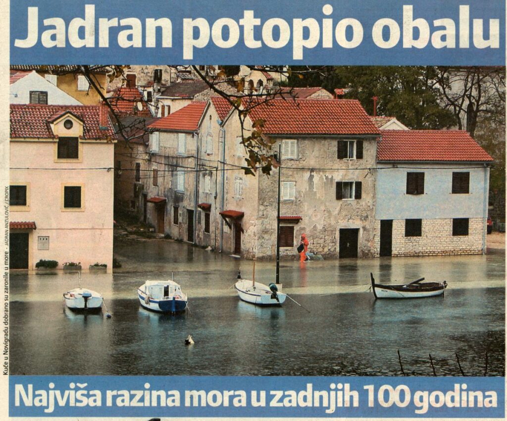
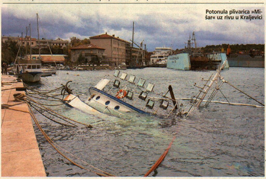
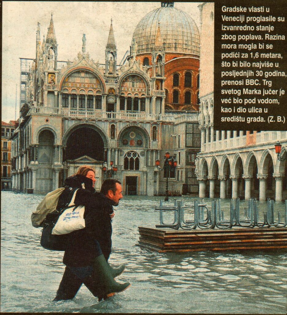
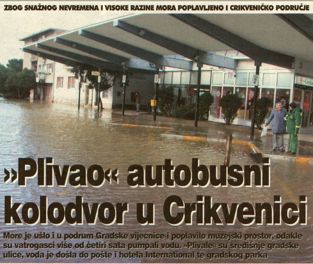
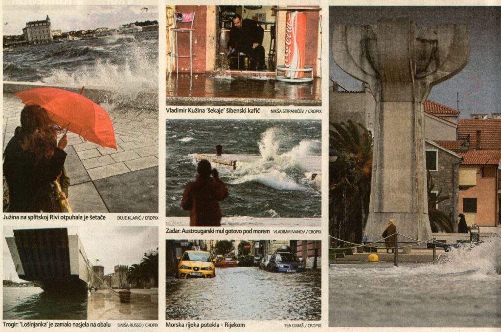
The following impacts of the flooding were reported in daily newspapers (Jutarnji list, 2 December 2008; Novi list, 2 and 3 December 2008; Slobodna Dalmacija, 2 December 2008; Večernji list, 2 December 2008; Vjesnik, 2 December 2008). On that day, coastal regions of the northern and middle Adriatic experienced exceptionally high sea levels. The storm flooded streets, squares, roads, farmers’ markets, beaches, shops, restaurants, cafes, and both residential and business areas along the coast, from Pula to Trogir.
In the Primorje-Gorski Kotar County, damages amounted to several tens of thousands of euros. The northern Adriatic experienced a particularly strong Sirocco, which uprooted trees in Pula and Opatija, while in Rijeka and surrounding areas, roofs were torn off buildings. The Regional Meteorological Department in Rijeka recorded Sirocco gusts of up to 25.7 m/s. Rough seas disrupted ferry schedules, with the connection between the mainland and Cres completely suspended.
In Karlobag, the Sirocco uprooted a 4-meter-high iron pole on the public beach and displaced multi-ton concrete slabs by 10 meters. Ferry and catamaran services in Zadar were also disrupted, with one ferry unable to dock at the port of Preko on the island of Ugljan. In Šibenik, dozens of cafes in the coastal Dolac area were flooded, with water reaching up to one meter in height. In Trogir, the historic city center suffered the most damage.
Additional pictures: Lokalpatrioti, Rijeka
