(16) Rogoznica, Nečujam, Milna, Korčula,
26 July 1987
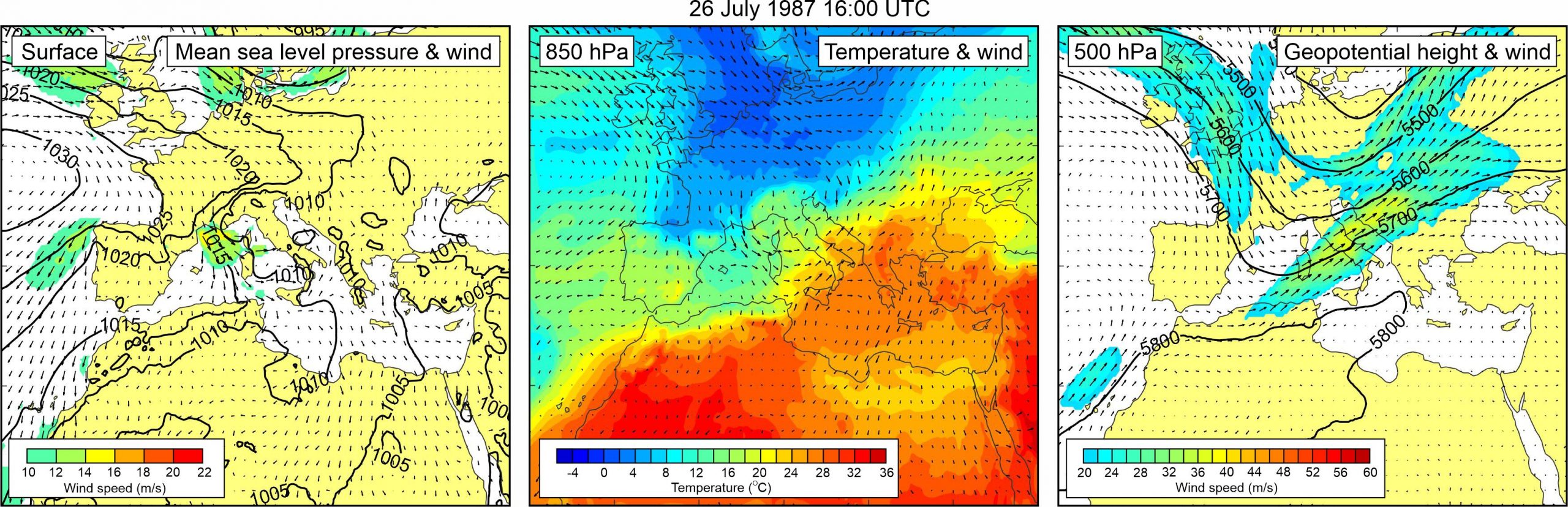
Figure 1. Synoptic situation at the time of the event: (left) mean sea level pressure and 10-m wind; (middle) temperature and wind at 850 hPa; (right) geopotential height and wind at 500 hPa.
The event is mentioned by Zore-Armanda (1988). The only detail given is the onset time at one of the locations (Milna on Brač island).
A high pressure field was spreading from the Atlantic towards the western Mediterranean resulting with pronounced pressure gradients over the Alps. Over the Adriatic Sea, mean sea level pressure field was almost uniform – thus no pronounced winds were blowing over the Adriatic Sea. At the 850-hPa level, warm air mass was advancing from the northern Africa across the central and eastern Mediterranean towards the Adriatic Sea. As a result, temperature gradients were pronounced over the middle Adriatic at the 850 hPa height. An upper level trough can be seen at the 500 hPa level – associated mid-tropospheric strong winds (up to ~40 m/s) of southwesterly direction blew at its front side, over the western Mediterranean and the Adriatic Sea.