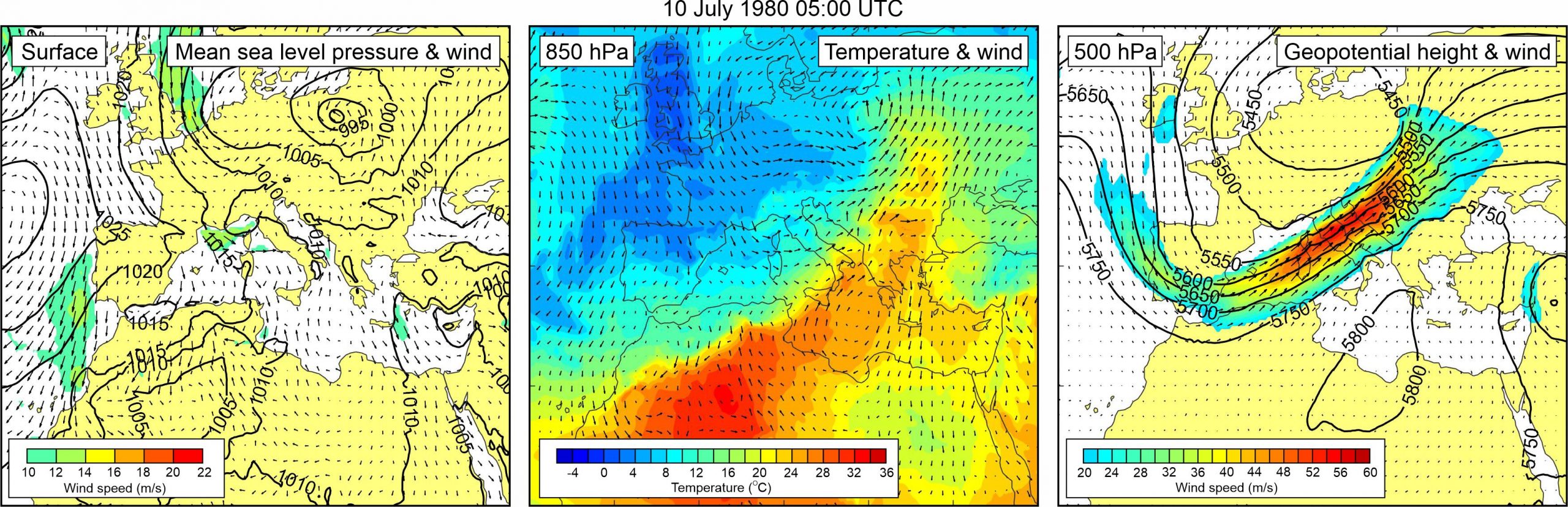
Figure 1. Synoptic situation at the time of the event: (left) mean sea level pressure and 10-m wind; (middle) temperature and wind at 850 hPa; (right) geopotential height and wind at 500 hPa.
It is thus stated that “the strongest sea level rise was the first one that occurred on Thursday at five o’clock in the morning… Sea level rose more than a meter, and in fact surpassed by 80 cm the level of Stari Grad coast… After about twenty minutes the sea suddenly receded, far below the usual level, and then the ropes on the ferryboat Gradac were broken… At approximately 17:30 hours another strong tidal wave flooded, but to a lesser extent, the coasts of Stari Grad Bay, whereupon the sea again receded thus causing damage to numerous boats that hit the dry bottom of the bay.”
In only one of the newspaper articles (Vjesnik, 11 July 1980) it is briefly mentioned that sea-level oscillations were also observed in Vela Luka but that their intensity was much smaller than that in Stari Grad; consequently, the oscillations did not cause any damage.
Again, the event coincided with a storm surge at Bakar.
A mid-latitude cyclone was centred over the northern Europe. Over the Mediterranean, mean sea level pressure field was relatively uniform (1010-1015 hPa). Over the Adriatic Sea, winds were weak, only exception being the Strait of Otranto where southern winds reached up to 12 m/s. At the 850 hPa level, a tongue of warm air was advancing from the central Sahara across the Eastern Mediterranean to the Adriatic Sea and further into the continental Europe. As a result, an upper-level temperature front developed over the Adriatic. At the 500 hPa level, a deep trough was located over the western and central Mediterranean Sea. At the front side of this trough, exceptionally strong mid-tropospheric winds (up to ~60 m/s) were blowing over the western Mediterranean and the Adriatic Sea.