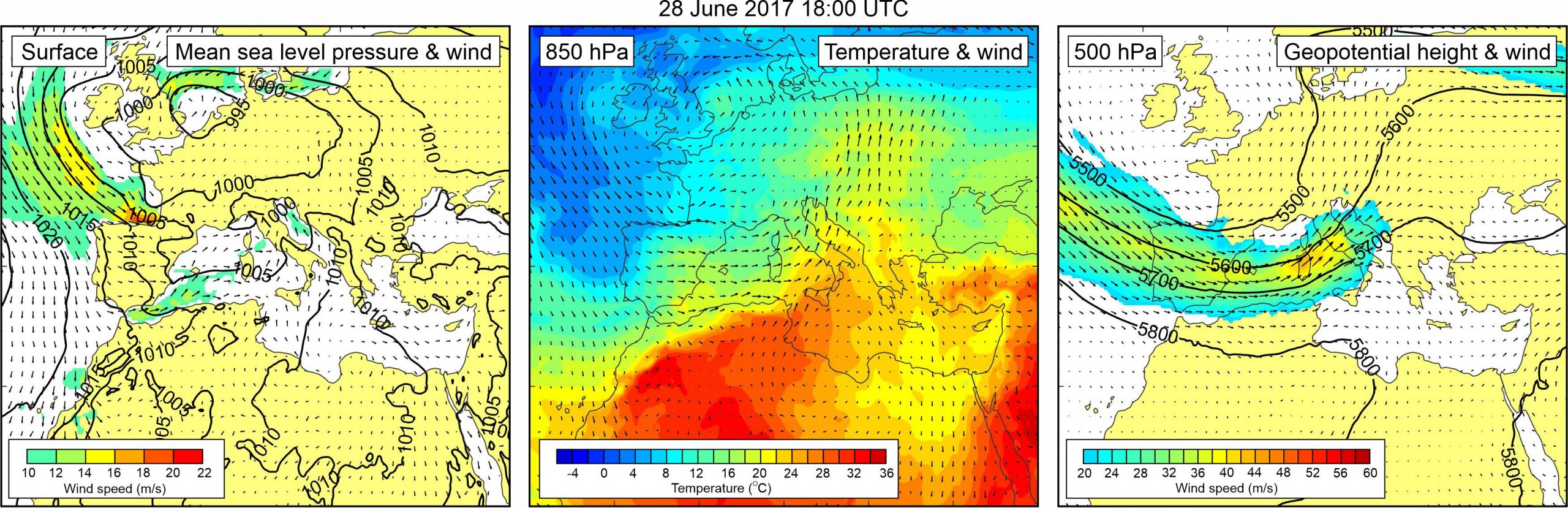
Figure 1. Synoptic situation at the time of the event: (left) mean sea level pressure and 10-m wind; (middle) temperature and wind at 850 hPa; (right) geopotential height and wind at 500 hPa.
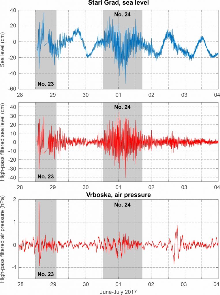
The event of 28 June 2017 started only one hour after installation of permanent tide gauge and meteorological station in Stari Grad harbour, both operated by the Institute of Oceanography and Fisheries in Split. According to available measurements, the event was generated by a pronounced air pressure disturbance, characterized by a min-to-max height of 3.3 hPa and duration of 37 min, which traversed Stari Grad between 15:20 and 16:00 UTC. Onset of sea level oscillations was simultaneous to the arrival of air pressure disturbance, but it continued for several hours after the disturbance passed. The most pronounced wave of 56.8 cm height was measured between 16:50 and 17:10 UTC, whereas maximum sea level elevation was recorded at 18:02 UTC, at the time of high tide, and in accordance with eyewitness reports which place the event between 18:00 and 19:00 UTC.
Atmospheric and sea level component of the event were numerically modelled using AdriSC modelling suite (using the Weather Research and Forecast model for the atmospheric component and ROMS/ADCIRC model for the ocean component), by Denamiel et al. (2019a, 2020).
A mid-latitude cyclone was centerd over the northwestern Europe, but spreading all the way to the Mediterranean. As a result, pressure gradients were present over the Adriatic Sea, and a weak sirocco wind (speeds up to 12 m/s) blew from the Strait of Otranto towards the northern Adriatic. At the 850 hPa level, a warm air mass was advancing from the western Sahara across the central Mediterranean to the Adriatic Sea and further into the continental Europe. As a result, an upper-level temperature front developed over the Adriatic. At the 500 hPa level, a trough was located over the Atlantic, the western Mediterranean and the Adriatic Sea. At the leading side of this trough, strong mid-tropospheric winds (up to ~35 m/s) were blowing over the Adriatic Sea.
Figure 2. Original and high-pass (T < 4h) sea-level time series measured at Stari Grad, and high-pass filtered (T < 4 h) air pressure time series measured at Vrboska, all during Event 23 and Event 24.