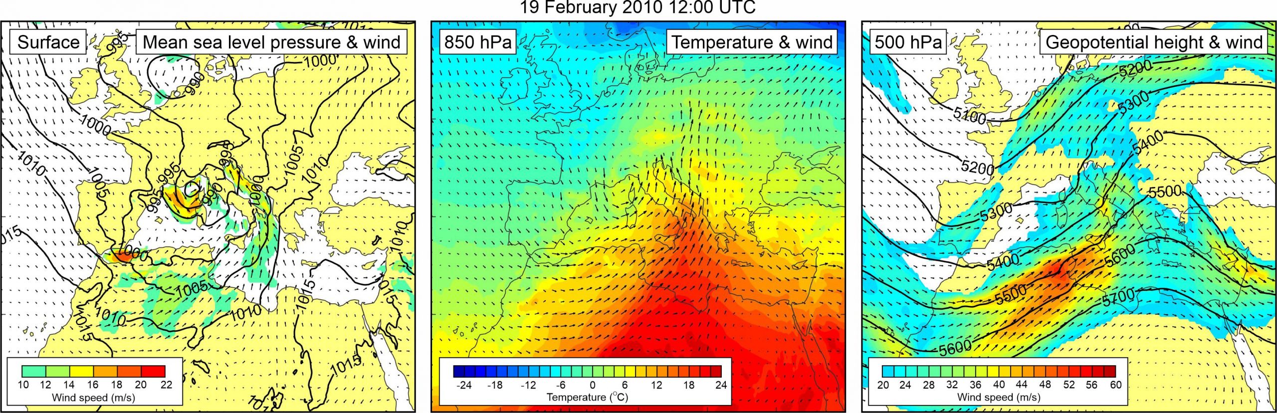
Figure 1. Synoptic situation at the time of the event: (left) mean sea level pressure and 10-m wind; (middle) temperature and wind at 850 hPa; (right) geopotential height and wind at 500 hPa.
This isone of the rare wintertime events and is described in three newspaper articles (Slobodna Dalmacija, 21 February 2010; Jutarnji list, 21 February 2010; Večernji list, 21 February 2010). The descriptions in this case are rather cursory; thus, for example, it is stated that “a large tidal wave, which on the Friday afternoon flooded a half of Stari Grad, resulted in considerable damage to the citizens… The inhabitants of Stari Grad claim that there were several tidal waves, with no less than 55 cm of the sea being poured out at the very beginning, and the sea, while receding, dragged along cars, containers, cans and everything on the waterfront.”
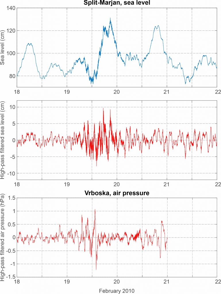
The event coincided with a storm surge at Bakar. Sea level measurements from Split-Marjan, the closest tide gauge station operational at the time, reveal some intensification of high-frequency sea level activity over the middle Adriatic during the event. Increased variability was also observed at other middle Adriatic tide gauge stations, as noted by Šepić and Vilibić (2011).
The meteorological forcing was also studied by Šepić and Vilibić (2011), who detected a small air-pressure perturbation that was propagating northeastward at a speed equaling (once again) 22-23 m/s. Herein we show this oscillation as measured at the 7-km distanced Vrboska microbarograph station.
The event was numerically reproduced using ADCIRC model by Bubalo et al. (2021). The simulations confirmed an assumption that flooding during this event was due to combined effect of storm surge and meteotsunami.
Surface synoptic situation was favorable for generation of storm surges in the northern Adriatic. A mid-latitude cyclone was centered over the Gulf of Lyon, and strong sirroco wind (> 16 m/s), was blowing along the Adriatic Sea. At the 850 hPa height, tongue of warm air mass was spreading from the central Sahara, across the central Mediterranean to the Adriatic Sea. As a result, an upper-level temperature front was present over the Adriatic Sea. At the 500 hPa level, a front side of a trough was located over the western Sahara, western Mediterranean and the Adriatic Sea. Associated upper-level winds reached speeds of more than 30 m/s over the Adriatic Sea.
Figure 2. Original and high-pass (T < 4h) sea-level time series measured at Split-Marjan, and high-pass filtered (T < 4 h) air pressure time series measured at Vrboska, all during Event 21.