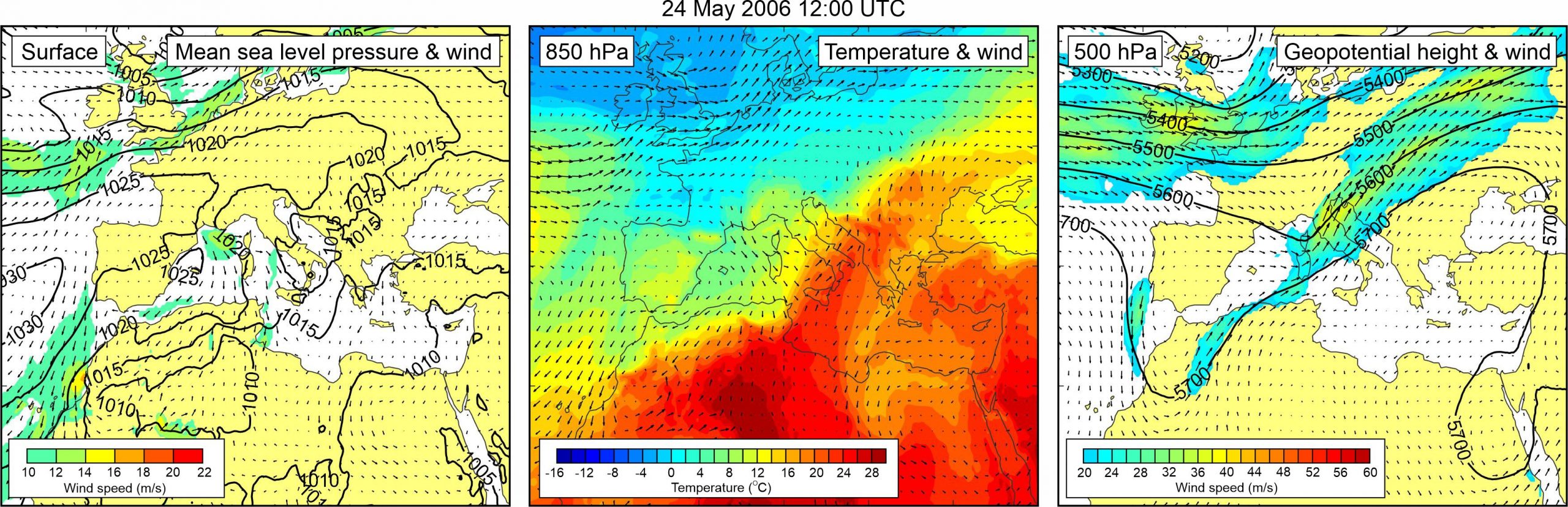
Figure 1. Synoptic situation at the time of the event: (left) mean sea level pressure and 10-m wind; (middle) temperature and wind at 850 hPa; (right) geopotential height and wind at 500 hPa.
In an e-mail message that the author received on 16 December 2006, Vera Irving says that she “witnessed a series of dramatic waves in Vrboska harbor. Our pilot book had warned us that this could happen in winter, if there was a strong sirocco. That was not the case on 24 May, so we asked the local people (who were also very surprised at the phenomenon), but they could offer no explanation as to why this should happen in May. Then I heard of the “resaca” in Menorca, which destroyed 40 boats, and after a bit of research, discovered that these waves can also happen due to an abrupt change in atmospheric pressure, which was the case in Croatia in May.”
A weak low was centred over the
southern Italy and southern Adriatic, not resulting with pronounced winds over
the Adriatic Sea. At the 850 hPa level, a tongue of warm air was advancing from
the central Sahara across the Central Mediterranean to the Adriatic Sea and
further into the continental Europe. As a result, a pronounced temperature
front developed over the Adriatic Sea. At the 500 hPa level, a shallow trough
was located over the northern Mediterranean. At the front side of this trough,
strong winds (up to ~40 m/s) were blowing over the Adriatic Sea.