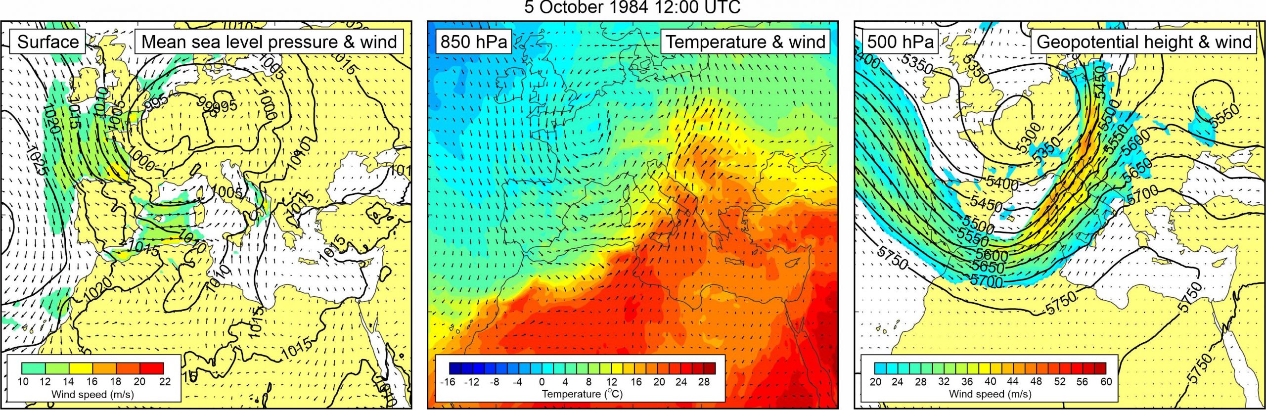
Figure 1. Synoptic situation at the time of the event: (left) mean sea level pressure and 10-m wind; (middle) temperature and wind at 850 hPa; (right) geopotential height and wind at 500 hPa.
This event on the island of Ist is briefly mentioned by Vilibić and Šepić (2009), who also publish the wave height as reported by eyewitnesses. Once again, the event coincided with a storm surge at Bakar.
Sea level measurements from the 120 km distanced Bakar tide gauge station reveal that high-frequency sea level oscillations were pronounced over the area during 2-5 October 1984, with two peak periods: the first one on 2 October 1984 when high-frequency sea level oscillations reached ~55 cm height; and the second one, coinciding with the Ist meteotsunami, on 5 October 1984 when high-frequency sea level oscillations reached ~45 cm height.
Regarding synoptic situation, a mid-latitude cyclone was centred over the northern Europe, but spreading all the way to the Mediterranean. As a result, pressure gradients were present over the Adriatic Sea, and sirocco wind (speeds up to 16 m/s) blew from the Strait of Otranto towards the northern Adriatic. At the 850 hPa level, a warm air mass was advancing from the central Sahara across the Eastern Mediterranean to the Adriatic Sea and further into the continental Europe. As a result, an upper-level temperature front developed over the Adriatic. At the 500 hPa level, a deep trough was located over the Atlantic, the western Mediterranean and the Adriatic Sea. At the front side of this trough, strong mid-tropospheric winds (up to ~45 m/s) were blowing over the western Mediterranean and the northern Adriatic Sea.
Sea-level time series measured at Bakar during Event 15.