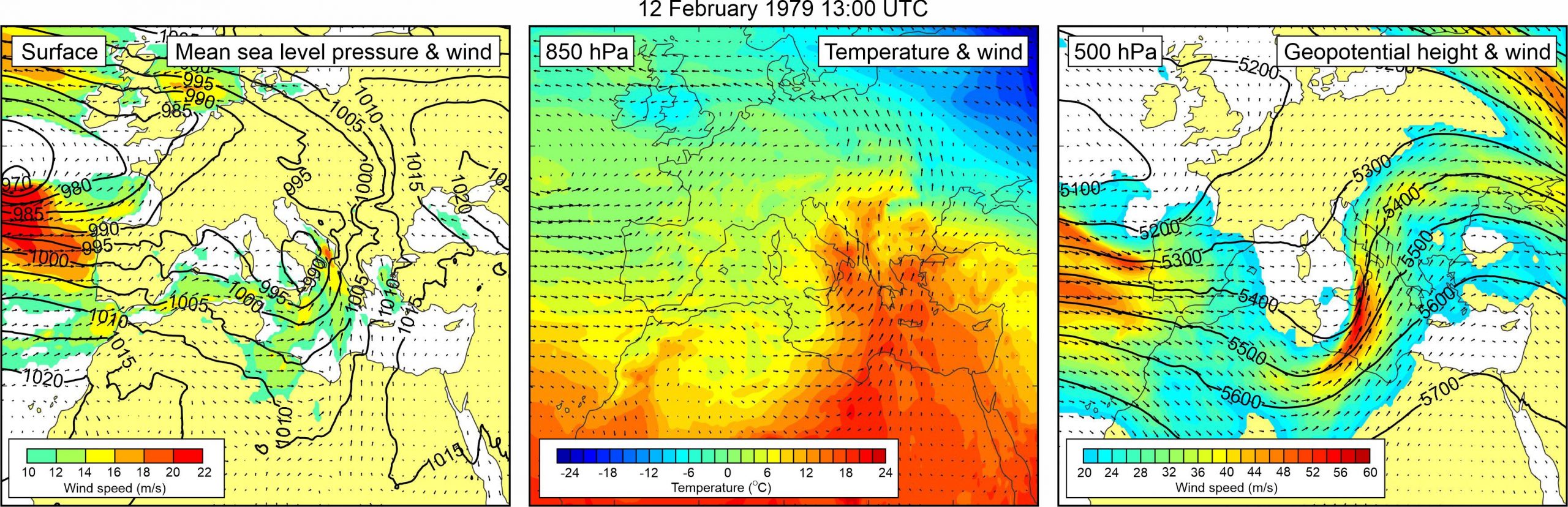
Figure 1. Synoptic situation at the time of the event: (left) mean sea level pressure and 10-m wind; (middle) temperature and wind at 850 hPa; (right) geopotential height and wind at 500 hPa.
Tabain and Tabain (1994) reproduce the record kept by the Harbor Master Office according to which “at approximately 13:00 hours a gradual rising and falling of sea level was again observed, and at approximately 14:30 hours a part of the road in the port area was flooded… All the time between 14:30 and 19:00 hours the sea was rising and falling, with sea level reaching ca. 1 m above mean value. The ebbs were small.”
It is also mentioned that the SE wind had a force of 4-5 Bf, the air pressure equaled 984 mbar and it was cloudy and foggy. The event coincided with a storm surge at Bakar.
A deep mid-latitude cyclone was centred over the southern Italy, resulting with a strong sirocco wind (> 20 m/s) blowing along the southern Adriatic Sea. At the 850 hPa level, a tongue of warm air was advancing from the central Sahara across the Eastern Mediterranean to the Adriatic Sea and further into the continental Europe. As a result, an upper-level temperature front developed over the Adriatic. At the 500 hPa level, a deep trough was located over the western and central Mediterranean. At the front side of this trough, exceptionally strong mid-tropospheric winds were blowing over the eastern Mediterranean (up to ~55 m/s) and the Adriatic Sea (up to ~40 m/s).