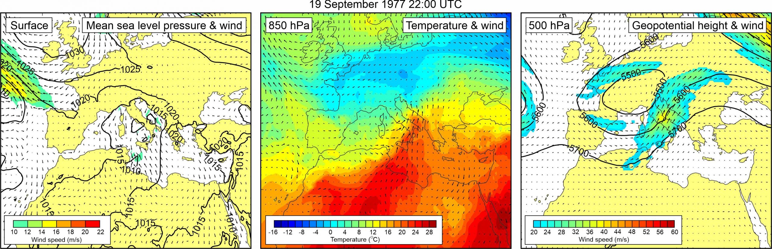
Figure 1. Synoptic situation at the time of the event: (left) mean sea level pressure and 10-m wind; (middle) temperature and wind at 850 hPa; (right) geopotential height and wind at 500 hPa.
The event is covered by two newspaper articles. In one of the articles (Vjesnik, 21 September 1977), it is emphasized that “unprecedentedly large differences between flood and ebb, amounting to four meters, kept in suspense hundreds of inhabitants… in the night between 19 and 20 September.” It is mentioned elsewhere in the article that the event started at approximately 22 hours in the evening, that until 2:30 hours in the morning the sea level rose and fell eleven times, and that the phenomenon was accompanied by a large storm, strong wind and heavy rain.
In another article (Slobodna Dalmacija, 22 September 1977), it is mentioned that “the sea flooded basements of many residential and other houses, especially in the Kale cove, and it also dragged to the bottom several boats that were tied to the coast. The phenomenon caused a considerable material damage.
Regarding the synoptic situation during the event, a weak low was present over the western Mediterranean and the Adriatic Sea. Weak sirocco wind (up to 10 m/s) was blowing over the southern, and weak bora wind (up to 10 m/s) over the northern Adriatic. At the 850 hPa level, a tongue of warm air mass was spreading from the central Sahara, across the central Mediterranean to the Adriatic Sea. As a result, a pronounced upper-level temperature front was present over the Adriatic Sea. A closed low was located over the central Europe at the 500 hPa level. At its front side, strong southwesterly mid-tropospheric winds (30 – 40 m/s) were blowing over the Adriatic Sea.