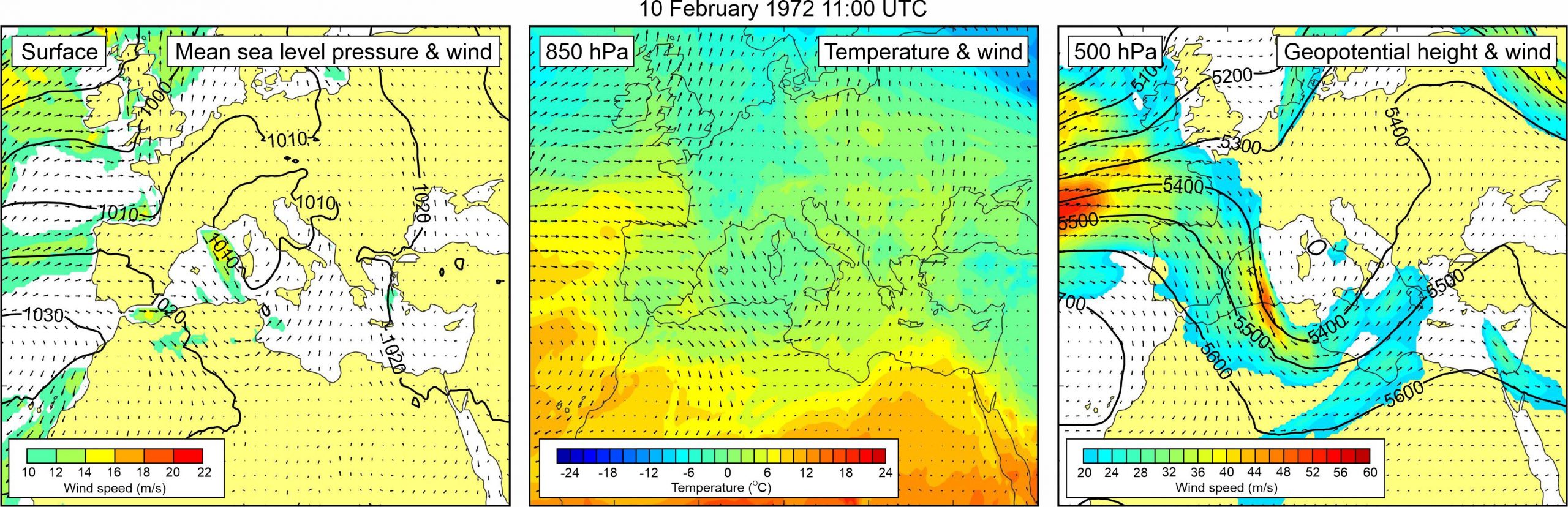
Figure 1. Synoptic situation at the time of the event: (left) mean sea level pressure and 10-m wind; (middle) temperature and wind at 850 hPa; (right) geopotential height and wind at 500 hPa.
Tabain and Tabain (1994) cite a report, issued by the Harbor Master Office, which states “on 10 February 1972 at approximately 11:00 hours sea-level rising and falling was observed in Vela Luka, and it culminated at approximately 16:30 hours with sea level reaching ca. 1 m above mean sea level… When sea level was at the maximum, a part of the road in the area of Kale and Vranac was flooded.”
Atmospheric reanalysis reveals that a weak low was present over the western Mediterranean and the northern Adriatic Sea. As no strong pressure gradients were related to this low, surface winds over the Adriatic sea were also weak. At the 850 hPa level, an inflow of warmer air from Africa can be detected across the eastern Mediterranean and the Adriatic Sea. However, there were no pronounced temperature fronts over the Mediterranean. At the 500 hPa level, a trough was located over the western Mediterranean – the strongest winds are found at its rear side over the westernmost part of the Mediterranean. Over the Adriatic Sea, there were no strong winds at 500 hPa level.