(6) Korčula and the channel off it, 27 August 1966
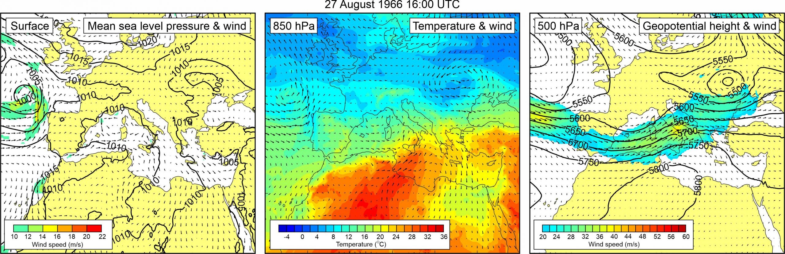
Figure 1. Synoptic situation at the time of the event: (left) mean sea level pressure and 10-m wind; (middle) temperature and wind at 850 hPa; (right) geopotential height and wind at 500 hPa.
This event is described with remarkable details in a newspaper article (Vjesnik, 29 August 1966). It is stated that in the town of Korčula and on the nearby Pelješac peninsula “between 16 and 18 hours sea level suddenly rose and fell eight times. Maximum difference in the height amounted to 165 cm.”
It is also mentioned that “the boats … remained for a while in the sea and afterwards they were in a danger of being trapped on the land. The area to the east of the Culture Center was … flooded by a half meter of water.”
The notice finishes with the statement that “nobody offered an explanation of the phenomenon up to now. Otherwise, there was a complete calm in both the sea and atmosphere. The sky was completely covered by clouds”.
Atmospheric reanalysis reveals that a weak, but wide, surface low was present over the northern Africa and western Mediterranean. Surface pressure gradients over Europe were weak, and thus, no strong surface winds were blowing. At the 850 hPa level, warm air was advancing from the northern Africa across the central Mediterranean towards the Ionian Sea, with pronounced temperature gradients over the Strait of Messina and the Ionian Sea, and somewhat less pronounced gradients over the Adriatic Sea. A moderate jet stream (> 20 m/s) was located across most of the western Mediterranean and the Adriatic Sea. Over the Adriatic Sea, the 500 hPa winds had southwesterly to westerly direction.