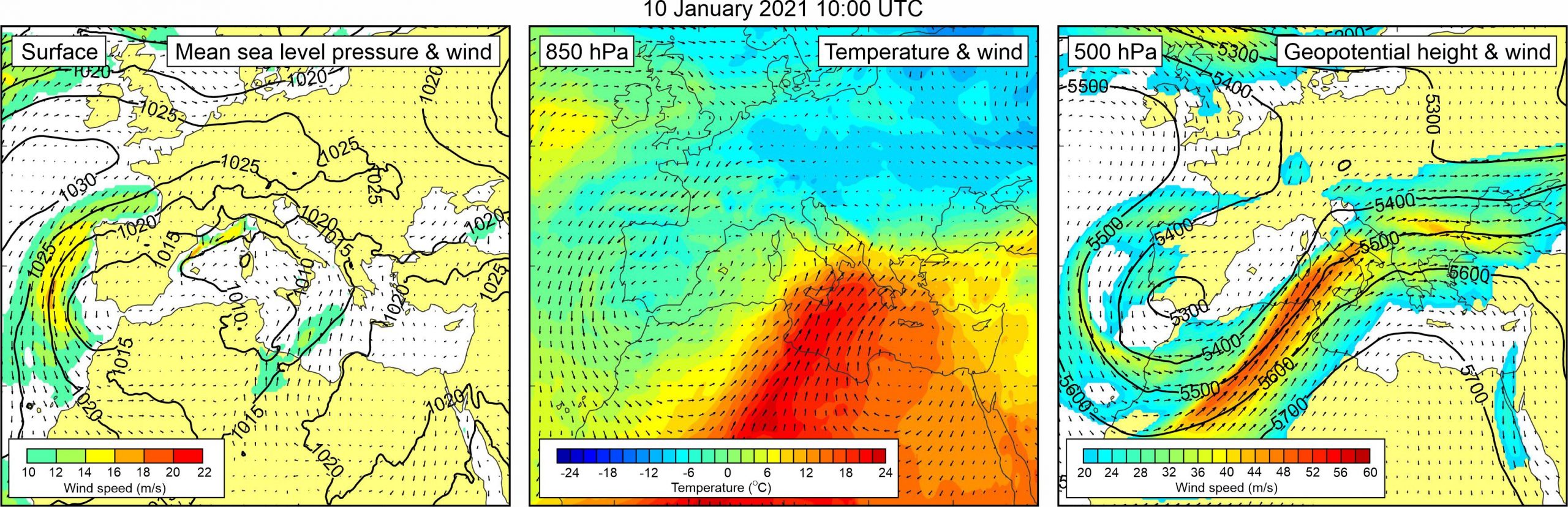
Figure 1. Synoptic situation at the time of the event: (left) mean sea level pressure and 10-m wind; (middle) temperature and wind at 850 hPa; (right) geopotential height and wind at 500 hPa.
Our attention to this event was drawn by Hrvoje Mihanović of the Institute of Oceanography and Fisheries (Split, Croatia), who detected this event during a routine check of Vela Luka tide gauge data. The event is also described in an online article (dubrovački vjesnik, 10 January 2021). According to the article, sea level oscillations were strong enough to dry inner parts of the harbour and leave the boats stranded, and to, subsequently, flood the promenade and road along the coast – but not strong enough to enter the houses.
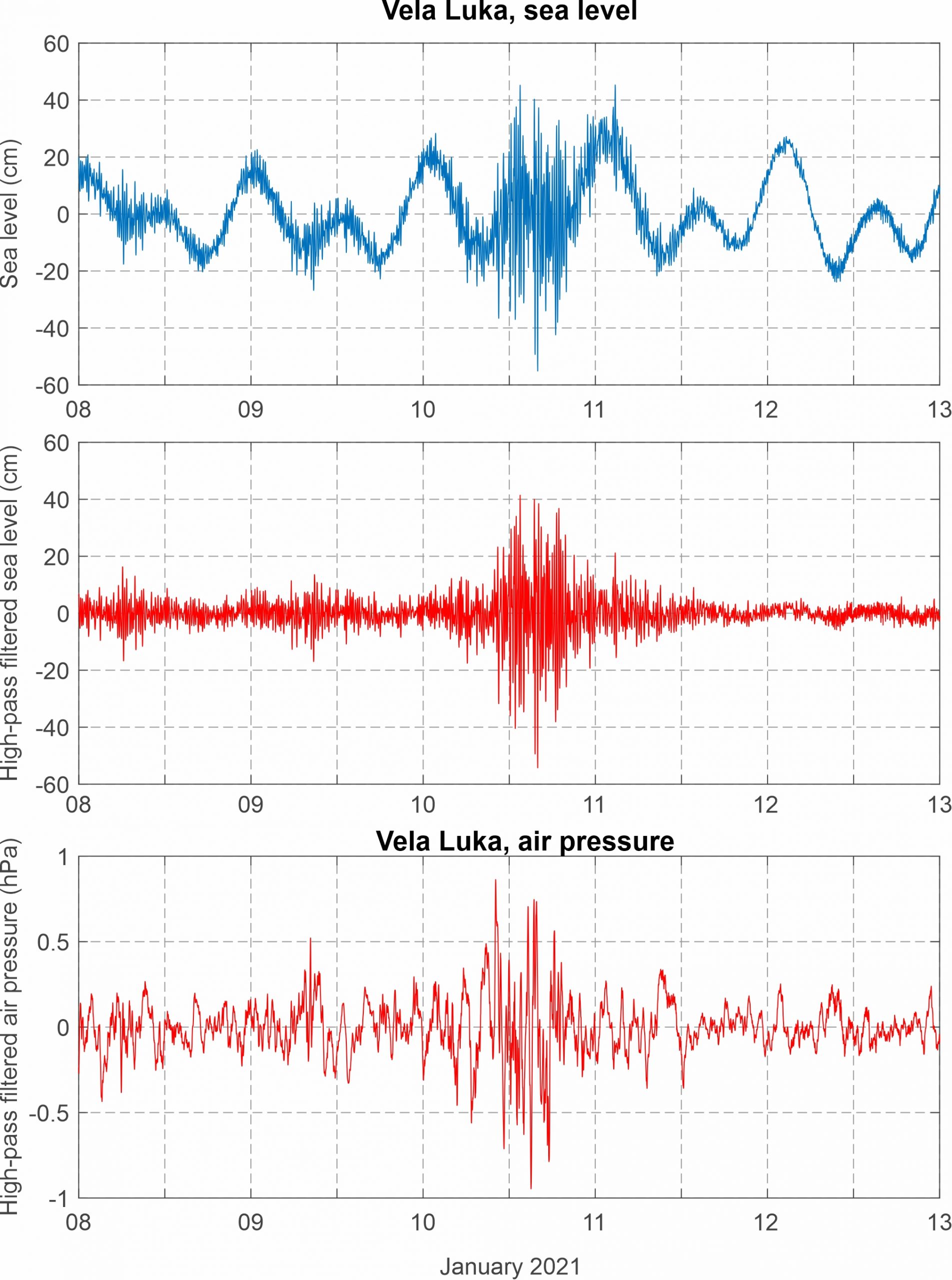
The Vela Luka tide-gauge measurements reveal that strong high-frequency sea-level oscillations started around 10:00 UTC and lasted up to ~20:00 UTC of the same day. The strongest wave was recorded between 15:58 and 16:19 UTC, reaching maximum height of 92.7 cm, with the wave trough (-54.2 cm) more intense than the wave ridge (38.5 cm), in accordance with the eyewitness reports. Air pressure time series from Vela Luka show that a series of high-frequency air pressure disturbances propagated over the area precisely during the same period (~10:00-20:00 UTC). The most pronounced of these atmospheric oscillations had height of 1.6 hPa and was recorded shortly before the strongest meteotsunami wave.
Weather reports imply that “dark bora” (bora scura), i.e. bora wind associated with rain and thunderstorms, was blowing over the area during the event. The wind was of weak to moderate strength (DHMZ, 2021).
Synoptic charts point to weak surface northerly winds over the southern and middle Adriatic – the winds are associated to a low centered over the western Mediterranean. At the 850 hPa, a warm air tongue was advancing from central Sahara, across the central Mediterranean, towards the Adriatic Sea. As a result, upper level temperature gradients were present over the Adriatic Sea. At the 500 hPa height, very strong south-westerly winds, associated to a front side of an upper level trough, blew over the Adriatic Sea.
Figure 2. Original and high-pass (T < 4h) sea-level time series measured at Vela Luka, and high-pass filtered (T < 4 h) air pressure time series measured at Vela Luka, all during Event 34.