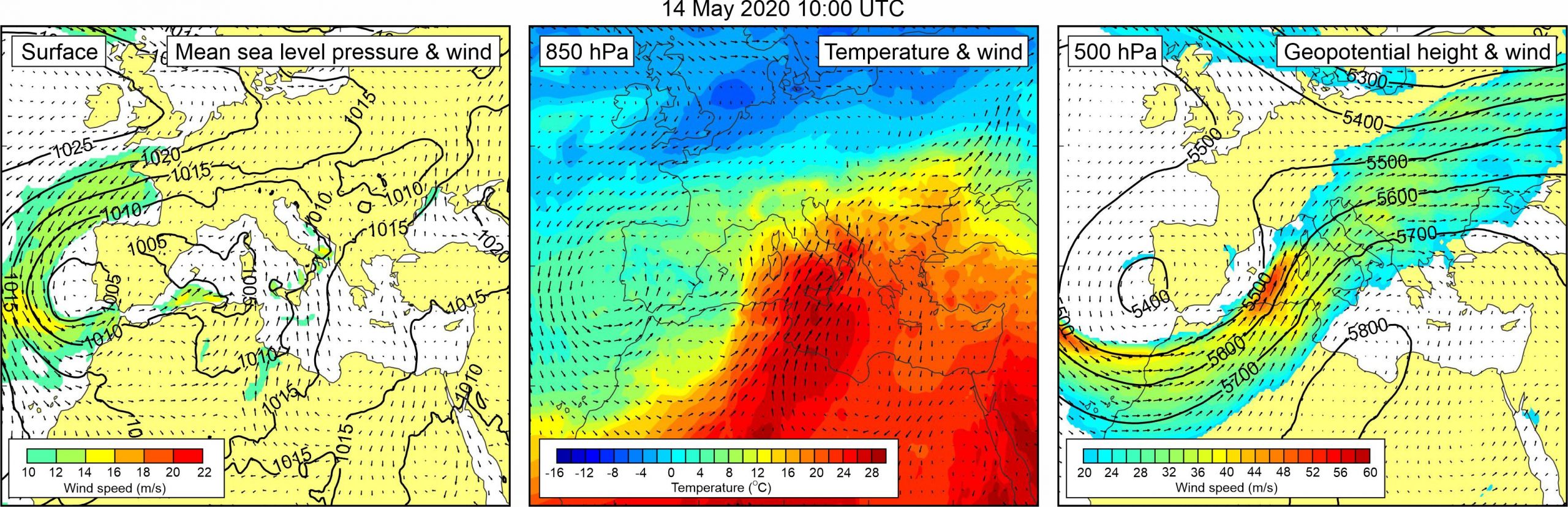
Figure 1. Synoptic situation at the time of the event: (left) mean sea level pressure and 10-m wind; (middle) temperature and wind at 850 hPa; (right) geopotential height and wind at 500 hPa.
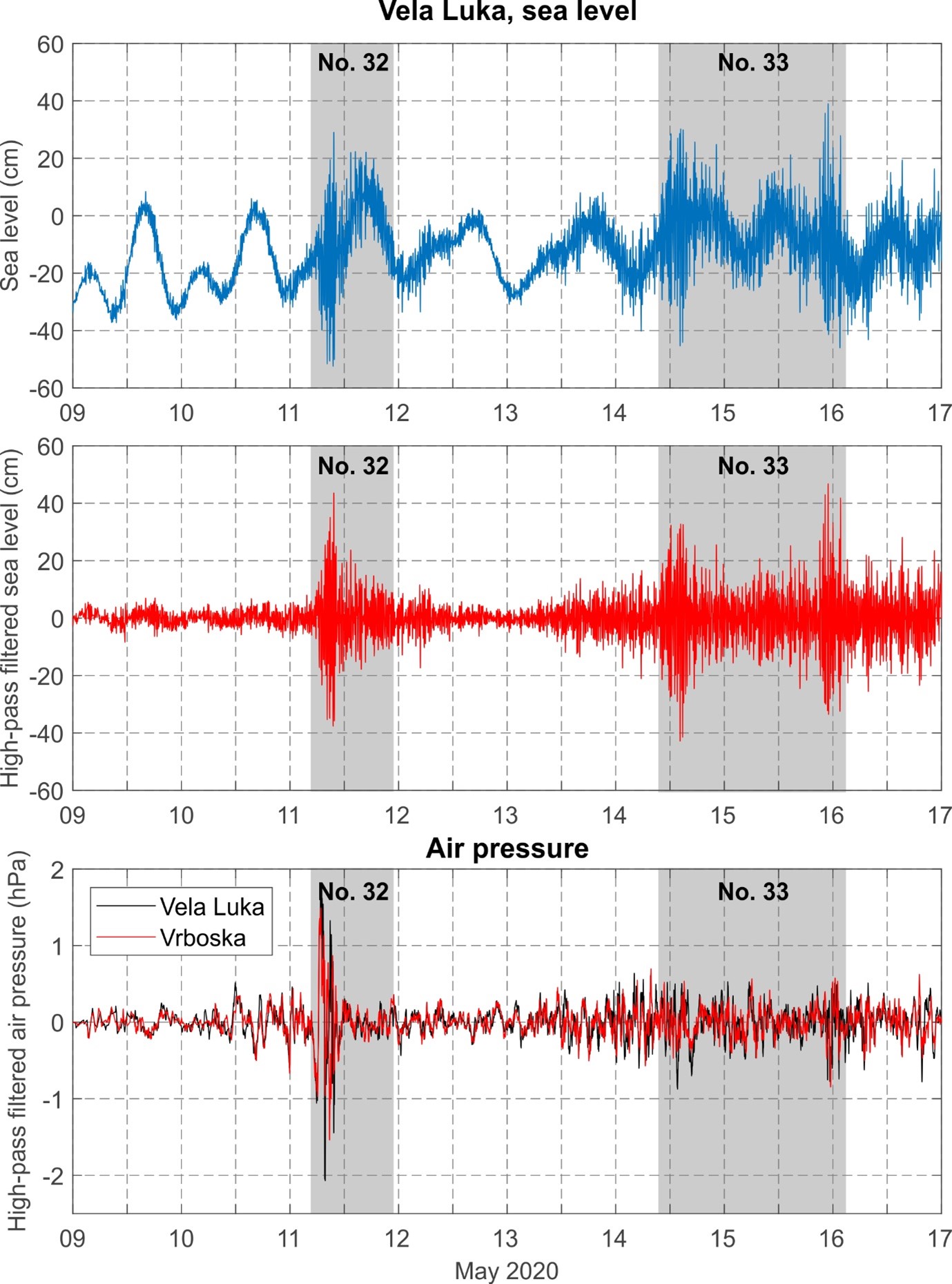
Only three days after the previous event, during 14-15 May 2020, meteotsunamis again occurred at Vrboska and Vela Luka. Descriptive information on Vrboska event come from on-line articles and YouTube (YouTube, 15 May 2020). According to these, strong sea-level oscillations were observed during early afternoon hours of 14 May. The oscillations had 5-6 min period and resulted in drying and 30-cm flooding of the bay. In Vela Luka, sea-level oscillations caused drying and flooding of the inner bay as well. Vela Luka tide-gauge measurements reveal that high-frequency sea-level oscillations were strongest between 10:00 and 16:00 UTC of 14 May, and then again between 21:00 UTC of 15 May and 02:00 UTC of 16 May. On 14 May, maximum wave of 71.0 cm height was recorded between 14:48 and 15:02 UTC, and average period of dominant oscillations was 12-13 min. On 15 May, maximum wave of 80.3 cm was recorded between 22:50 and 23:03 UTC, and average period of dominant oscillations was 16-18 min. In spite of fact that sea-level oscillations were equal or even somewhat stronger than those observed three days earlier, air pressure data from both Vrboska and Vela Luka reveal much weaker air pressure disturbances reaching maximum heights of 1.4 hPa (both locations), and maximum 5-min rates of air pressure oscillations of -0.7 hPa/5 min (Vrboska), i.e. -1.1 hPa/5 min (Vela Luka). Nonetheless, the high-frequency air pressure oscillations were present through a better part of 14-15 May 2020. Both atmospheric and ocean component of the event were numerically modelled by Tojčić et al. (2021) with the meteotsunami module of real-time one-way coupled atmosphere-ocean AdriSC model.
Synoptic situation slightly differed from the situation during the Event 32 which occurred three days earlier. Synoptic situation over Europe was now dominated by a low off the Portuguese coast with related weak mean sea level pressure gradients over the Mediterranean and the Adriatic Sea. Over the Adriatic Sea weak sirocco was blowing, reaching speeds from 10 to 16 m/s. At the 850 hPa, a warm air mass was advancing from the central Sahara, across the central Mediterranean towards the Adriatic Sea. As a result, an upper-level temperature front was still well developed over the Adriatic Sea. At the 500 hPa height, strong south-westerly winds (up to 38 m/s), related to a deep low, blew over the Adriatic.
Figure 2. Original and high-pass (T < 4h) sea-level time series measured at Vela Luka, and high-pass filtered (T < 4 h) air pressure time series measured at Vela Luka and Vrboska, all during Events 32 and 33.