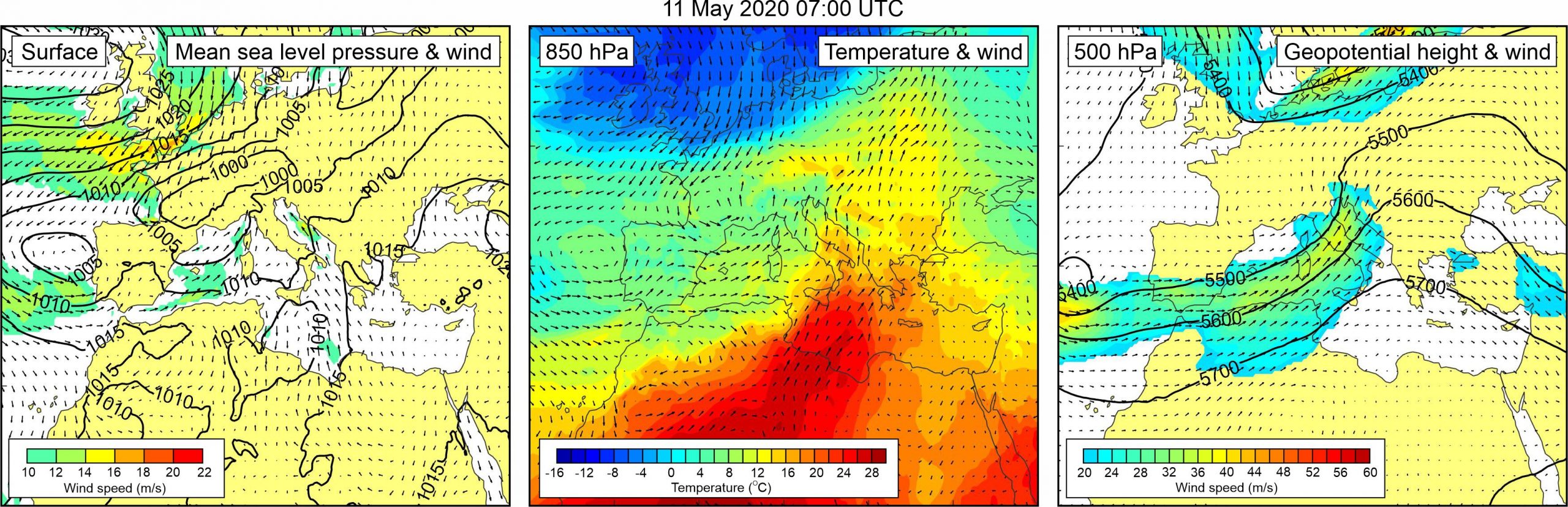
Figure 1. Synoptic situation at the time of the event: (left) mean sea level pressure and 10-m wind; (middle) temperature and wind at 850 hPa; (right) geopotential height and wind at 500 hPa.
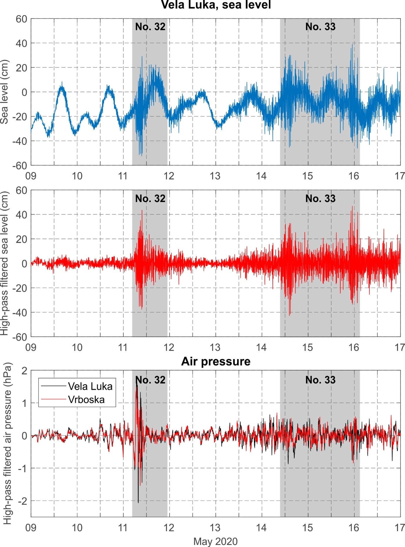
On 11 May 2020 strong high-frequency sea-level oscillation occurred at Vela Luka and Vrboska. The event was stronger in Vrboska where, according to articles (Dalmacija Danas, 11 May 2020) and YouTube video (YouTube, 11 May 2020), sea-level oscillations reached 1-1.5 m height. During periods of low water, parts of the harbour were dried, and during periods of high water, sea level caused >10 cm high flooding. Period of oscillations was 5-6 min. The event occurred in Vrboska during morning hours of the day. On Korčula Island, in Vela Luka, sea caused a couple of cm high flooding. According to the tide gauge measurements, high-frequency sea-level oscillations in Vela Luka intensified around 07:00 UTC. The wave with maximum height (81.2 cm) was measured between 9:33 and 9:41 UTC. Dominant period of Vela Luka waves was 16-18 min. Intensified high-frequency sea-level oscillations were also recorded in Stari Grad between 06:00 and 14:00 UTC, with wave of maximum height (63.0 cm) recorded between 10:55 and 11:20 UTC. However, we were not able to find reports on related flooding, and thus assume that sea-level oscillations in Stari Grad did not reach critical height (> 100 cm) to classify the event as a meteotsunami. Air pressure data measured at Vrboska reveal that between 06:06 and 10:41 UTC four air pressure disturbances of similar duration passed over the area – these disturbances had maximum associated height of 2.5 hPa, and maximum 5-min rate of air pressure change of -1.6 hPa/5 min. Similar, but even stronger, air pressure oscillations were recorded at Vela Luka between 05:53 and 10:46 UTC; maximum associated height was 3.9 hPa, and maximum 5-min rate of air pressure change was -2.1 hPa/5 min. During the events, a strong sirocco wind blowed over the middle Adriatic (DHMZ, 2020b). Both atmospheric and ocean component of the event were numerically modelled by Tojčić et al. (2021) with the meteotsunami module of real-time one-way coupled atmosphere-ocean AdriSC model.
Synoptic situation over Europe was
dominated by a low over the western Europe, with related weak mean sea level
pressure gradients over the western Mediterranean and the Adriatic Sea. Over
the Adriatic Sea weak to moderate sirocco wind was blowing, reaching speeds up
to 16 m/s. At the 850 hPa, a warm air tongue was advancing from the
western Sahara, across the central Mediterranean towards the Adriatic Sea. As a
result, an upper-level temperature front developed over the Adriatic Sea. At
the 500 hPa height, strong south-westerly winds (up to 40 m/s) blew over
the Adriatic.
Figure 2. Original and high-pass (T < 4h) sea-level time series measured at Vela Luka, and high-pass filtered (T < 4 h) air pressure time series measured at Vela Luka and Vrboska, all during Events 32 and 33.