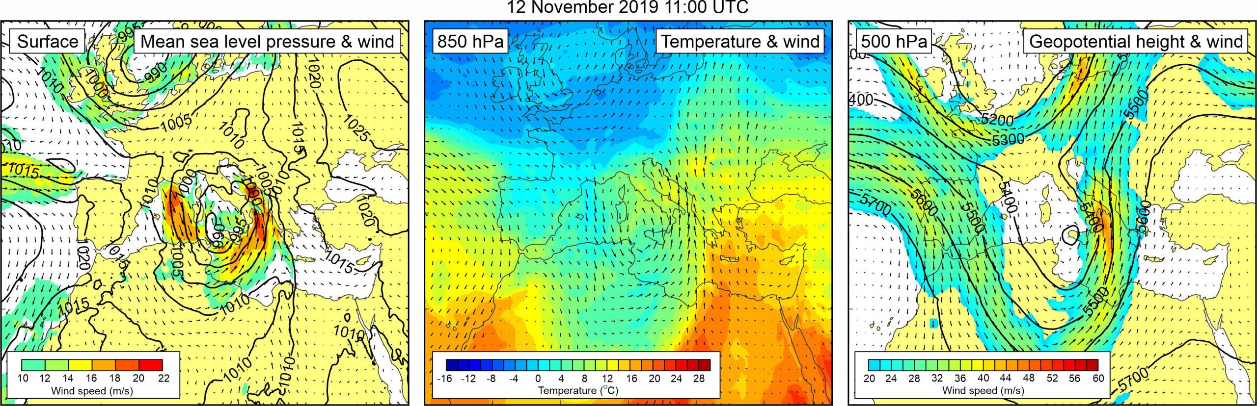
Figure 1. Synoptic situation at the time of the event: (left) mean sea level pressure and 10-m wind; (middle) temperature and wind at 850 hPa; (right) geopotential height and wind at 500 hPa.
Our attention to this event was drawn by Mrs. Marion Podolski, a Hvar resident, who contacted us and wrote a very detailed blog post on the subject (Podolski, 2019), accompanied with photos and videos of the event. The video which depicts a small advancing meteotsunami bore is particularly impressive. The event coincided with a synoptic-scale atmospheric low which propagated over the western Mediterranean and the Tyrrhenian Sea (DHMZ, 2019) and which generated storm surges, strong south-eastern winds and exceptionally high wind waves in the Adriatic. The Croatian Hydrographic Institute reports that the record-breaking (over the Croatian coast of Adriatic) 10.87 m high wind wave was recorded offshore of Dubrovnik on that day (HHI, 2019).
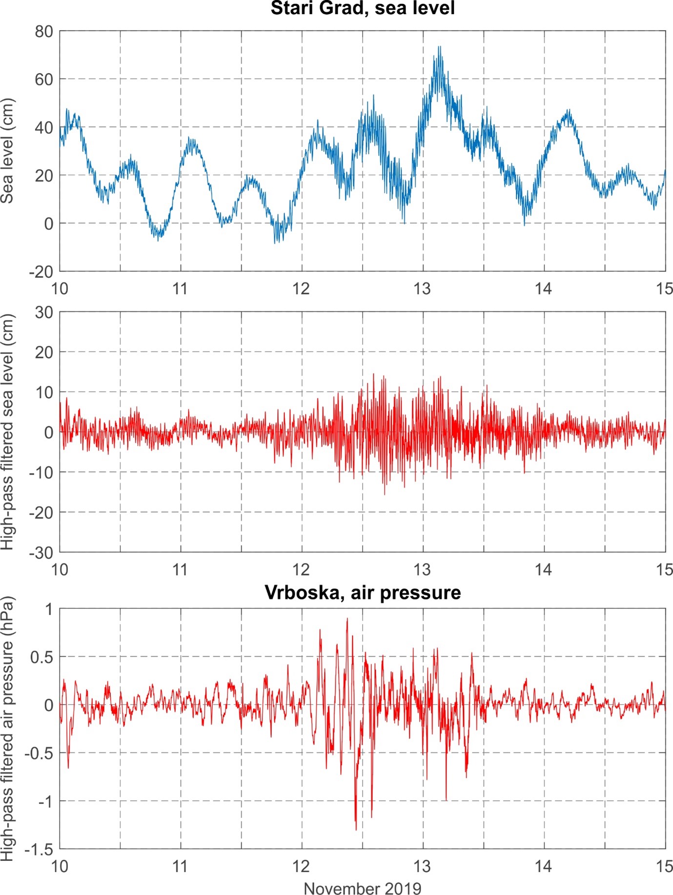
As for the Vrboska meteotsunami, according to Mrs. Podolski, wave height of oscillations was above 1 m, period of oscillations was ~5-6 min, and duration of the entire event was a few hours. Oscillations were strongest around noon local time (11:00 UTC), and then again at undefined time during the afternoon. The meteotsunami resulted in ~10-cm high flooding of the coast. Sea level measurements from the nearby Stari Grad tide gauge reveal an intensification of high-frequency activity precisely during a storm surge, however no meteotsunami occurred in Stari Grad. Maximum sea level in Stari Grad reached 73.56 cm, out of which only 13.8 cm were due to the high-frequency sea-level oscillations, and rest was due to the storm surge and tidal contribution. As for the mesoscale atmospheric processes, air pressure measurements from Vrboska reveal increased high-frequency activity from the early morning hours of 12 November up to the midday of 13 November with the strongest air pressure disturbance, characterized by an air pressure change of 1.5 hPa over 4 min, passing over the area around 13:40 UTC. The atmospheric disturbance was recorded in Stari Grad at approximately the same time, with air pressure change reaching 2 hPa over 5 min.
Surface synoptic situation was favorable for generation of storm surges in the Adriatic Sea. A mid-latitude cyclone was centered over the western Mediterranean, its center close to the Strait of Messina. Exceptionally strong sirroco wind (> 20 m/s), was blowing along the southern Adriatic Sea. At the 850 hPa height, tongue of warm air mass was spreading from the eastern Sahara, across the eastern Mediterranean to the southeast Europe, only marginally passing over the Adriatic Sea. At the 500 hPa level, a front side of a deep trough was located over the eastern Mediterranean and the Adriatic Sea. Associated upper-level winds reached speeds of up to 40 m/s over the Adriatic Sea.
Figure 2. Original and high-pass (T < 4h) sea-level time series measured at Stari Grad, and high-pass filtered (T < 4 h) air pressure time series measured at Vrboska, all during Event 30.