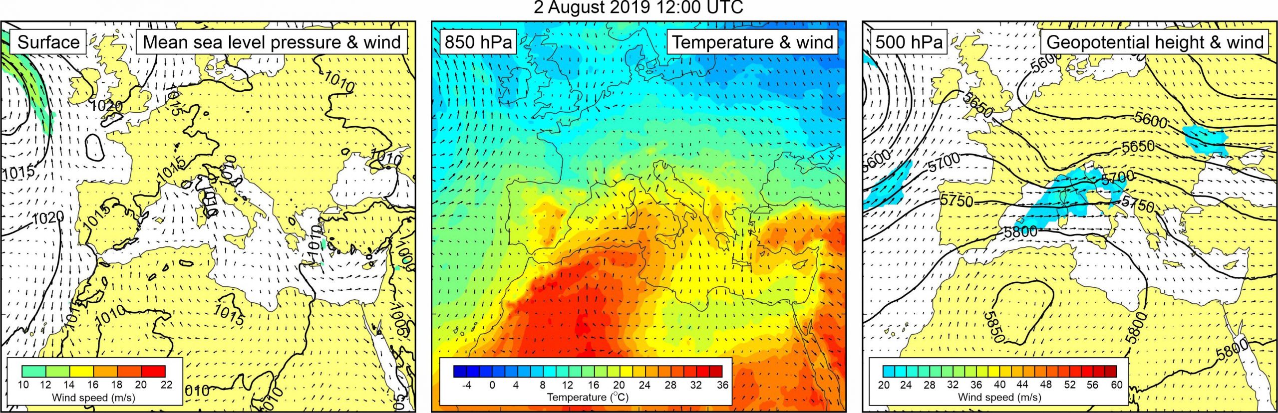
Figure 1. Synoptic situation at the time of the event: (left) mean sea level pressure and 10-m wind; (middle) temperature and wind at 850 hPa; (right) geopotential height and wind at 500 hPa.
Our attention to this event was drawn by the Ist islands residents when Jadranka Šepić visited the island to gather information about a strong meteotsunami which hit Široka Bay on Ist Island in May 2021 (Event 35). Residents reported that in a summer of 2019 similar event hit Kosirača, a bay located on the opposing side of the island. At this occasion, oscillating sea flooded the coastal roads and entered the houses. According to eyewitness reports height of oscillations was more than 1 m. It is interesting that at nearby Široka Bay strong high-frequency sea level oscillations occur relatively often, whereas the residents of Kosirača Bay describe the 2019 event as “something not seen before or after”. We were able to find only one newspaper report (057Info, 2019) in which this event might be remotely mentioned, and in which two photos of flooded and stranded boats can be seen. According to the article, the event was associated to wider area thunderstorms and was accompanied with strong wind gusts, wind waves, and flooding related to “tidal wave” (a phrase which islanders use to describe longer-period waves) and wind-waves at a number of locations, including Biograd on the coast, where seven cars were pulled to the sea.
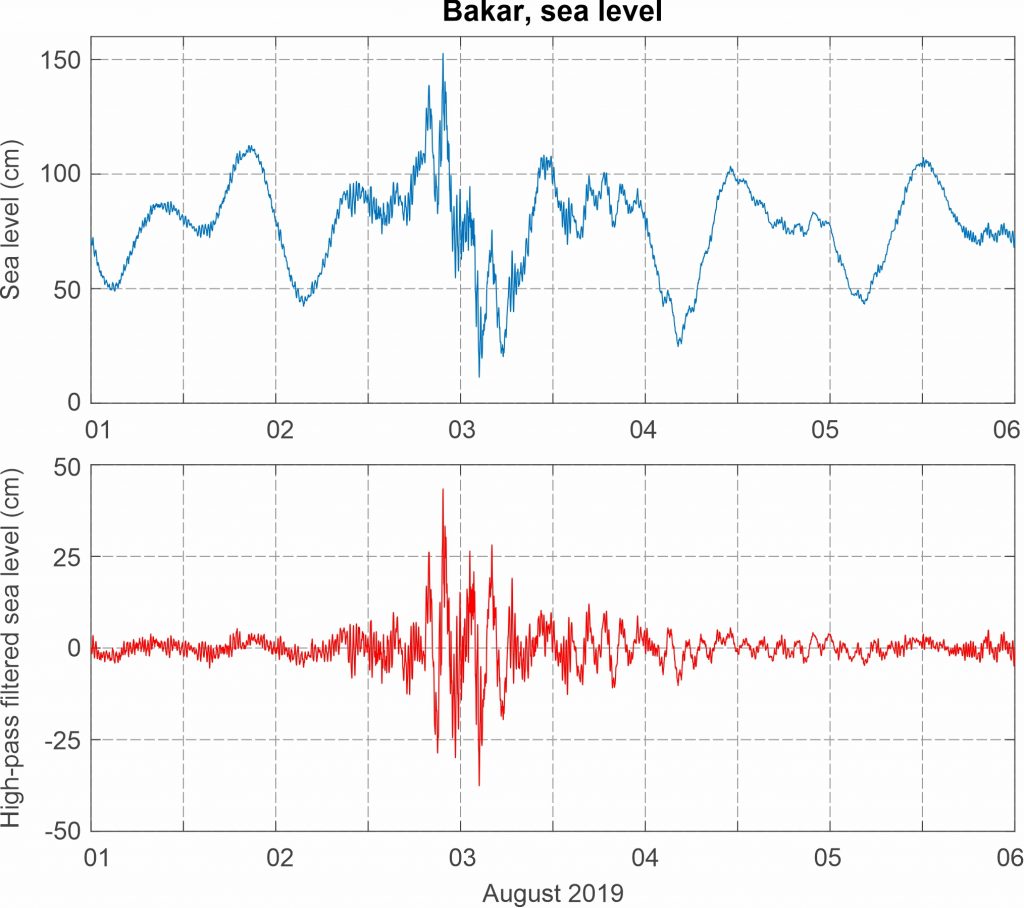
An increase of high-frequency variability was detected at the ~120 km distanced Bakar tide gauge station. Sea level oscillations of ~2 h period were intensified from the evening hours of 2 August till the early morning hours of 3 August, reaching maximum crest-to-trough height of 73.4 cm.
Synoptic analysis reveals that a field of slightly lowered mean sea level pressure was positioned over the western Mediterranean. At the 850 hPa height, a warm air tongue was advancing from the western Sahara, across the western Mediterranean towards the Adriatic Sea. As a result, moderate upper-level temperature gradients were present over the Adriatic Sea. At the 500 hPa height, moderate south-westerly winds (up to 24 m/s) blew over the Adriatic.
Figure 2. Original and high-pass (T < 4h) sea-level time series measured at Bakar during Event 29.