(31) Sumartin, 5-6 February 2020

Our information on this event comes from the article (Slobodna Dalmacija, 6 February 2020) in which it is said that a strong “tidal wave” (common local expression for long period waves) shoved numerous boats (at least six according to photos) from the harbour to the nearby road. During this event, bora wind, with occasional gale and hurricane strength, blew over the area (DHMZ, 2020a). It is unclear whether the waves which shoved the boats to the coasts were wind generated or tsunami-like waves.
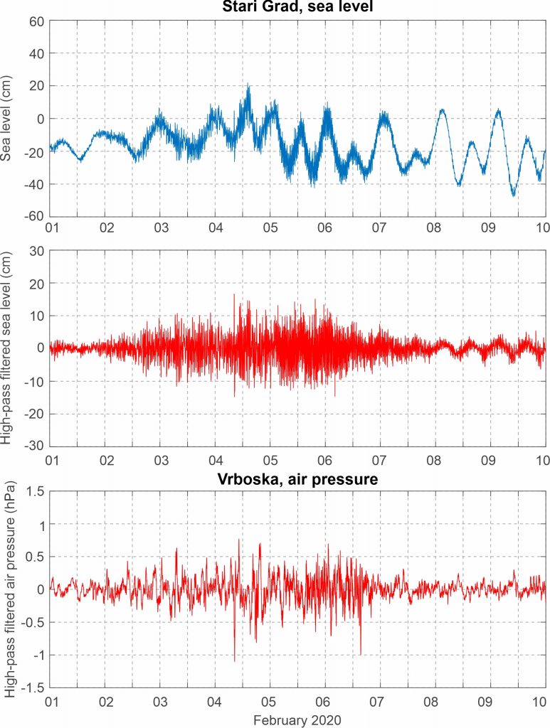
Sea level measurements from the closest tide gauge station, Stari Grad, reveal a weak intensification of high-frequency sea level activity during 2-7 February 2020. Air pressure measurements from the nearby station Selca (the Croatian amateur meteorological network Pljusak) reveal no pronounced air pressure disturbances during the event, but measurement from Vrboska station reveal intensification of high-frequency atmospheric activity during 2-7 February 2020, concurrent with intensification of sea level activity.
Synoptic situation during the 5-6 February 2020 event was non characteristic for the Adriatic meteotsunamis. A mean sea level pressure low was centered over the eastern Mediterranean and the Black Sea. At its rear side strong northerly surface wind blew over the Adriatic Sea, with speeds up to 18 m/s. At the 850 hPa level, cold air was spreading from Russia towards the Adriatic and the Mediterranean. At the 500 hPa level, a closed low was present over the eastern Europe and the eastern Mediterranean. Upper-level winds associated to this low were exceptionally strong, reaching speeds of more than 50 m/s along its perimeter.
